Tax Sale Results
Serving Tax Sales Investors Since 2005
Bancroft
Bancroft Ridge Dr. (Waterfront 24.06 Acres), Bancroft
Minimum Tender Amount: $27,258.00
File Number: HSBT23-32
Minimum Tender Amount:
$27,258.00
$27,258.00
Assessed Value:
$120,000 (2023)
$120,000 (2023)
Highest Valid Tender:
19 tenders, sold for $203,687.00
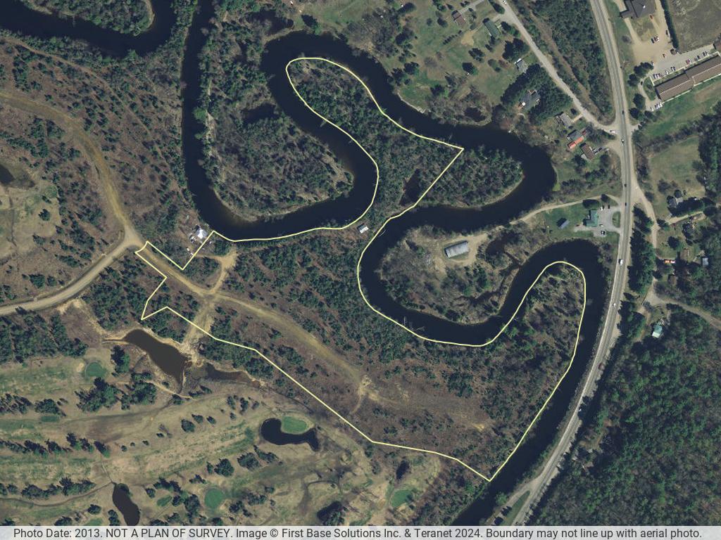
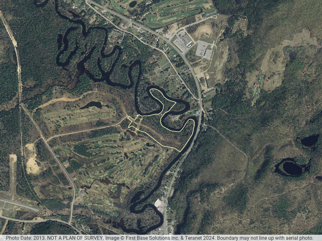

There are 3 aerial photos of this property. The aerial photos were taken in the Spring of 2013. The boundary may not line up exactly with the photo and it may not be a current representation of the structures (if any) as shown in the image. Photographs are for convenience only. Neither the municipality nor Ontario Tax Sales Inc. can guarantee their accuracy.
© OpenStreetMap contributors
The arrow is pointing at the property
Municipal Address:Bancroft Ridge Dr.
Legal Description:PART LOTS 71, 72, 73 & 74 WHR FARADAY LYING WITHIN THE LIMITS OF PART 1 21R21839 & EAST OF 21M223; S/T EASEMENT AS IN HT17358; FARADAY; BANCROFT; COUNTY OF HASTINGS (FOR FUTURE REGISTRATIONS SEE LAND REGISTRAR); SUBJECT TO AN EASEMENT AS IN HT17358; TOWN OF BANCROFT
PIN:40079-0124 (LT)
Roll Number: 12 62 000 020 09601 0000
Property Size: 24.06 Acres (MPAC)
Annual Taxes: Available in the InfoPak
Assessed Value: Available in the InfoPak
Is the property on a lake or bay or river: Yes
Is there a house or cottage on the property: No
Is there some other structure on the property: Yes
Zoning:Residential Type One – Exception Three – Holding (R1-3-h) Zone; Residential Type One – Exception Three – Holding – Floodprone (R1-3-h(f)) Zone; Natural Hazards – Exception Two (H-2) Zone
Is it possible to obtain a building permit: No
Waterfront: Yes
Vacant land: Yes
Additional info: Official Plan Land Use Designations: Urban Residential -Special Development Policy 2.2.7, Urban Environmental Protection, Urban Environmental Protection Provincially Significant Wetland; No frontage on public street. 0.3m reserve at the end of Bancroft Ridge Dr. (Plan 21-M223)