Tax Sale Results
Serving Tax Sales Investors Since 2005
Laurentian Valley
TAX SALE POSTPONED BY THE TOWNSHIP - 39 Sawmill Rd (10.99 Acres), Pembroke
Minimum Tender Amount: $81,006.51
File Number: RWLV22-01
Minimum Tender Amount:
$81,006.51
$81,006.51
Assessed Value:
$40,000 – Class IX
$40,000 – Class IX
Highest Valid Tender:
Tax Sale Was Postponed
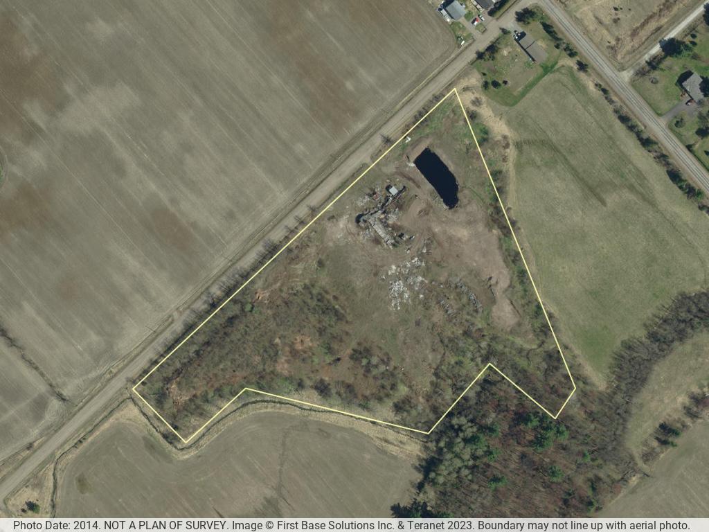
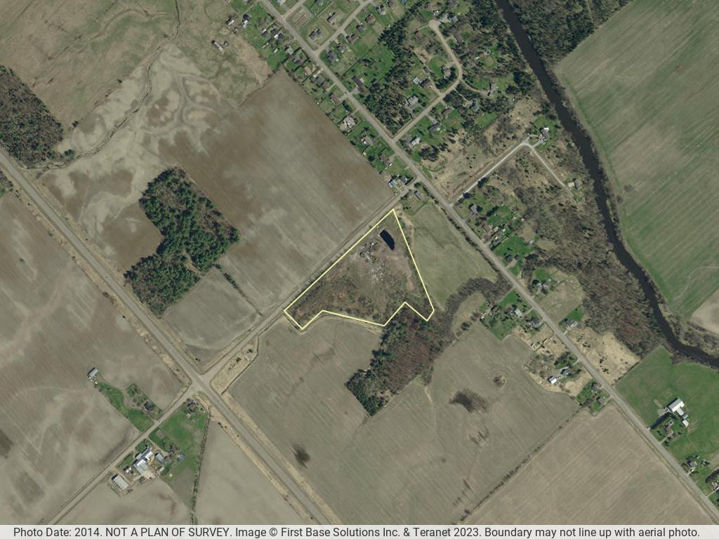

There are 3 aerial photos of this property. The aerial photos were taken in the Spring of 2014. The boundary may not line up exactly with the photo and it may not be a current representation of the structures (if any) as shown in the image. Photographs are for convenience only. Neither the municipality nor Ontario Tax Sales Inc. can guarantee their accuracy.
© OpenStreetMap contributors
The arrow is pointing at the property
Municipal Address:39 Sawmill Rd., Pembroke
Legal Description:PT LT 24, CON 1, STAFFORD, PT 1, 49R4487; TOWNSHIP OF LAURENTIAN VALLEY
PIN:57145-0009 (LT)
Roll Number: 47 66 066 015 02305 0000
Property Size: Area: 10.99 acres (4.447 ha); Frontage: 1093.79 sq ft (101.613 m2); Depth; irregular
Annual Taxes: Available in the InfoPak
Assessed Value: Available in the InfoPak
Is the property on a lake or bay or river: No
Is the property accessible by a public or private road: Yes
Is there a house or cottage on the property: No
Is there some other structure on the property: Yes, former sawmill structure in disrepair
Zoning:General Industrial (GM) with Environmental Protection (EP) along creek at rear of property – zone provisions attached; For further information regarding Zoning, contact: Lauree Armstrong, Township Planner - 613-735-6291 Ext 203
Comments:
Building Permit: For permitted uses subject to site plan control, Building Code and any other applicable approvals, i.e. MTO
Comments:
Rezoning: Any application for zoning by-law amendment would be subject to review for compliance with the Township Official Plan, the PPS and any other applicable legislation. Additional supporting studies may be required for certain changes. Pre-consultation is required.
Waterfront: No
Commercial / industrial: Yes
Additional info: Former industrial use of lands, may be sawdust piles to be removed prior to redevelopment. The rear lot line abuts a creek and the lands in that portion are zoned EP and are subject to a 30-metre setback from the high-water mark. It is noted that the lot is in an area serviced by individual private wells and septic systems. A portion of the lot is also, within the corridor-controlled area of Highway 17 where MTO permits and approvals may also be required prior to redevelopment.